
My rental car at Vincent Gap.

Four miles to the summit, and every step is uphill!

Gaining altitude quickly, looking down to Hwy 2.

It was so pretty, and I was so grateful to be here. Some see a bench, I see an altar. I knelt and said a prayer of thanksgiving.
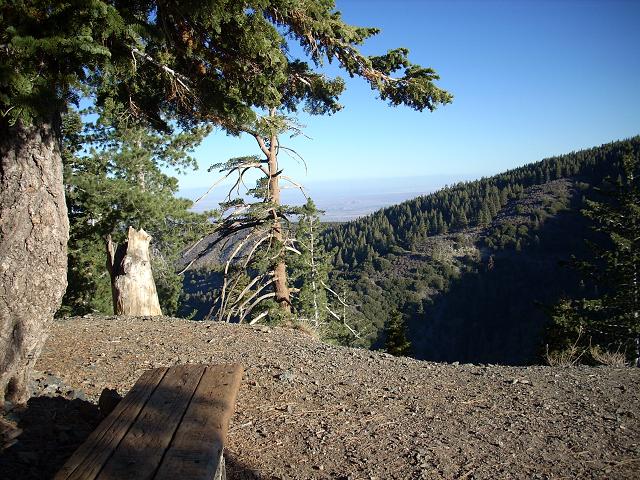
The view from my altar.

There are almost constant views of the Mojave desert to the north.

Gaining altitude. Hwy 2.

About .8 miles and 350 vertical feet to go.

I was surprised to see snow above 9000'. No snow on the trail.
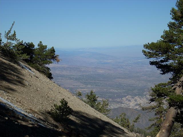
Desert view.

Desert view.

Desert view.

Awesome tree and desert view.

The higher you go, the more you see.

First glimpse of the summit.

Getting closer.

How does a tree survive on the steep side of this mountain!

Looking towards Mt. Blady. The bottom is (I think) the upper reaches of the East Fork of the San Gabriel river, over 3000' below. Very steep mountain side!

This last stretch is steep! It's been almost four miles of uphill walking already!

I always take pictures of trail signs for planning future trips.

Wally Waldron tree.

About the Wally Waldron tree.

The tree's proximity to the trail makes it difficult to get a good picture.

Summit monument and register.

I figured since someone went to the trouble of spelling CALTECH '71, the least I could do was take a picture of it.

I love the view to the north!

View to the west, with Mt. Wilson in the distance.

Looking towards Victorville and Barstow.

I stayed up here for about an hour. I was alone. It was quite windy, but I sat on the lee side of the monument, out of the wind and in the sun. Hmmmm...

Looking northwest.

Me on the summit of Mt. Baden-Powell.

Beginning the descent.

Trail sign. I've only been to Lamel Springs one time, and I recall it was very serene. So I decided to go again.

I didn't reach the spring. The trail is quite narrow and looks to be quite unstable. I do not take chances, especially when I am hiking alone. I turned around and continued my descent. What a wonderful day!