|
Nyerges Survival Walk
Gabrielino Trail
Mt. Wilson
Map 1
Map 2
|
Part 1 - Nyerges Survival Walk
|
|
Father Mike and his lovely wife Diane graciously offered to give me
a ride from my sister's home in Garden Grove to Altadena as we would
be attending
Christopher Nyerges' survival walk
in the Arroyo Seco area of the Angeles National Forest. |

|
|
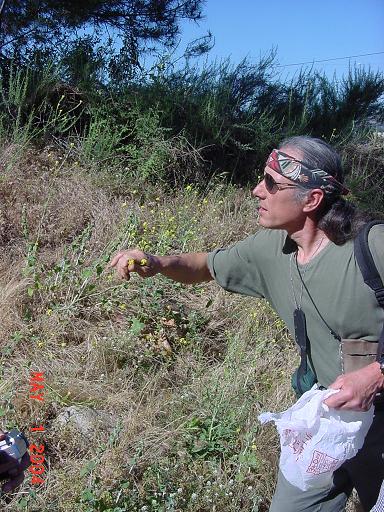
Christopher collects wild mustard. The yellow flower heads are
edible raw with a taste like broccoli.
|
|
|
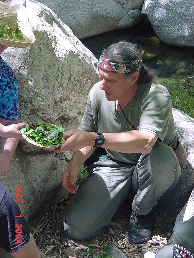
Christopher stops to discuss another plant. Notice the plastic
bag in his right hand. One hardly notices that he is stuffing
the bag with greens as he walks and talks. This will become a
delicious salad at the end of the walk.
|

|
|
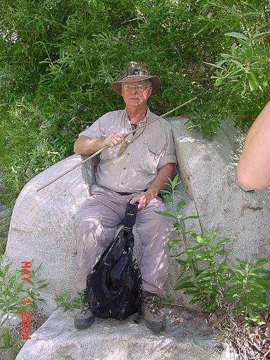
Fellow Hoodlum Dude McLean.
|

|
|
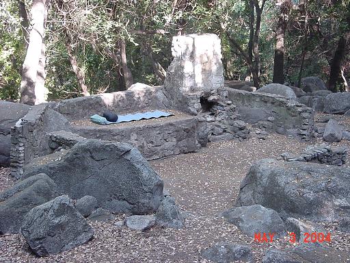
Dude discovered this rock while on an earlier outing.
|

|
|
The king or the court jester?
|
|
|
A queen worthy of this throne.
|

|
|
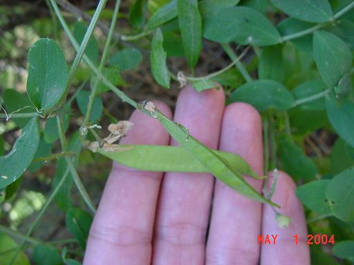
Wild pea.
|
|
|
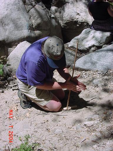
Christopher demonstrates fire starting using an old headlight
as a parabolic reflector.
|
|
|
Blowing the tinder into flame.
|

|
|
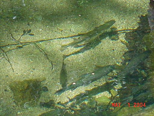
The stream had recently been stocked with trout, but we did
not take time to fish.
|
|
|
The aforementioned salad.
|
|
|
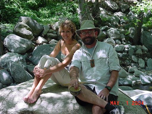
Father Mike and Diane.
|
|
|
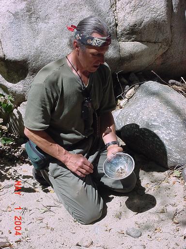
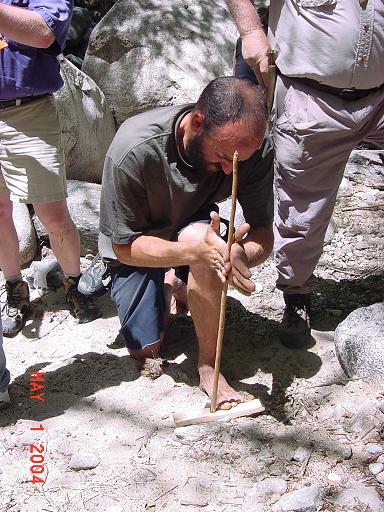
Scott gets his first ember with a hand drill, using
a mulefat spindle and a willow base.
|
|
|
Julio gives the hand drill a spin (pun intended.)
|
|
|
Father Mike, Bill Qualls, Dude McLean and Christopher Nyerges.
|

|
|
Gary frequently attends Christopher's walks. Anyone living in
southern California and interested in survival would be well
advised to do the same!
|

|
|
Dude McLean and Father Mike
|

|
Part 2 - Gabrielino National Recreation Trail
|
|
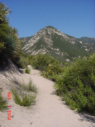
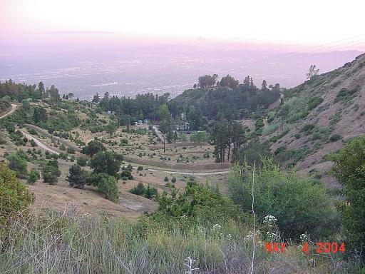
As the class returned to their cars, I continued hiking. I wasn't
exactly sure where I was going to go or how long or how far. As it
turned out, I completed the Gabrielino National Recreation Trail,
which runs 28 miles from JPL in Pasadena to Chantry Flats. This
photo was taken just above the Paul Little picnic area.
|

|
|
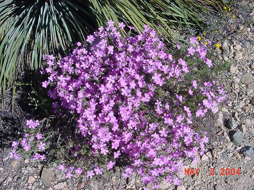
Some welcome color.
|

|
|
Some of the creeks were already dry. And it's only May!
|

|
|
Here's a picture taken at the same location in April 2001!
|

|
|
I had a nice conversation with a scoutmaster at Oakwilde: we
both grew up in Whittier. I then continued on to
Switzer Falls. This is a long uphill trek - about 1500' elevation
gain over 3 miles. It is always a relief to get to the top.
|
|
|
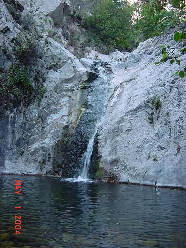
I took the Bear Canyon trail to Switzer Falls. It was late -
around 6pm - and the canyon was completely shadowed.
Nevertheless, I went for a swim. It's a ritual of sorts...
|
|
|
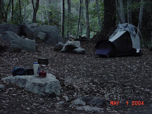
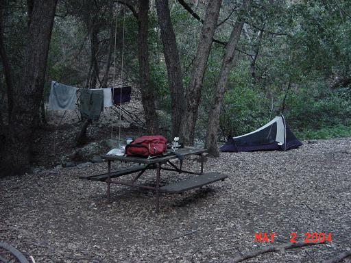
My campsite just below Switzer Falls.
|
|
|
I had a visitor that night - I didn't see it, but I have no doubt
it was a bear. I was just falling asleep when I heard the sound
of something large coming down the hillside which was covered
in scrub oak leaves. It stopped abruptly and began "sniffing"
(though it sounded more like "snorting".) I suspect he was on
his way to pilage through some trash (more on that later)
when he realized there was a person where none was expected. I
yelled (I freely admit to a totally irrational fear of bears!)
and never heard anything again.
|
|
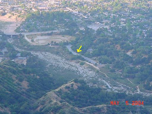
Sunday morning I planned to hike to Switzers picnic area (about
1.5 miles) before cooking breakfast. There I met a large group
of Armenians who invited me for breakfast. I had bread, cheese,
hard boiled eggs, and ice cold Pepsi! So much better than the
oatmeal I was planning on eating. These Armenians know how to
party, and it's only breakfast! Grandma told me "Armenians are
nice people." Yes, ma'am!
|

|
|
Bears make a mess of visitor trash.
|

|
|
Note the bear-proof trash cans.
The trash you are seeing is not from the trash cans, but left behind
by visitors who took the time to carefully bag their garbage and
take it to the already-full trash cans. These visitors should have
just taken their trash home, but most don't know that. And the USFS
will spend more in time and money cleaning up the mess than they would
spend on large bear-proof dumpsters. The result is a beautiful picnic
ground which is trashed, and bears with bad habits that are never
forgotten, thereby endangering the bears.
|
|
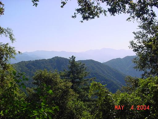
Enroute from Switzers to Red Box. Another 1300' elevation gain over
4.5 miles.
|

|
|
More welcome color.
|
|
|
Looking down the Angeles Crest Highway from just below Red Box.
|

|
|
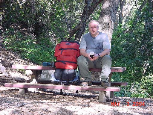
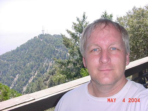
Me at Red Box. I like this picture as this is how I see myself.
|

|
|
On the Gabrielino trail between Red Box and Valley Forge.
|

|
|
Valley Forge campground. I like this campground: it is better
maintained than most. But it was too early to stop for the day,
so I continued on to Devore trail camp.
|

|
|
My camp at Devore. No one else here. It was very peaceful. I hiked
about 12 miles today.
|
|
|
My wife usually makes Sweet and Sour Pork for me on my birthday.
This was OK, but not even close. I really like the chili mac and beef
stroganoff dinners though!
|

|
|
I hung my pack every night.
|

|
|
It's a steep climb from Devore trail camp to Newcomb Pass - 1115'
elevation gain over 1.5 miles. Do the math: that's an average grade
of 14 percent! I completed the climb in one hour.
|
|
|
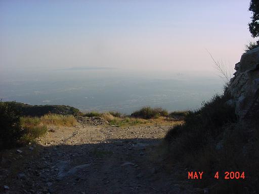
The view towards Chantry Flats from just below Newcomb Pass.
Chantry Flats is 6.2 miles away.
|

|
|
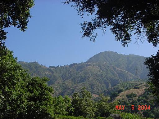
My first glimpse of Mt. Wilson - I'll be there tomorrow.
|

|
|
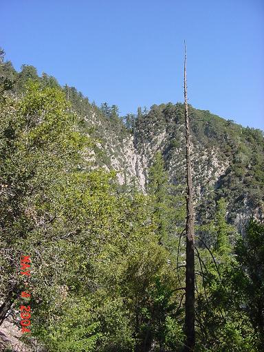
The inner canyon trails are beautiful.
|

|
|
The trails outside the canyons are also beautiful...but warm!
|

|
|
Sign at Chantry Flats. Chantry Flats is the end of the Gabrielino
National Recreation Trail.
|

|
|
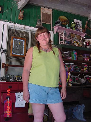
Kim is the owner of
the store and pack station at Chantry Flats.
I spent about two hours talking with Kim, enjoying the shaded
comfort of her porch and drinking cold Pepsi.
|
|
Part 3 - Mt. Wilson Hike
|
|
I reluctantly left the pleasant conversation and continued on to
Hoegee's campground. It is a 3 mile hike from Chantry to Hoegees,
on a usually-pleasant grade.
|

|
|
On the Upper Winter Creek Trail to Hoegees.
|

|
|
The ruins of an old cabin at Hoegees provided my bed for the night.
Once again, I was the only person in the campground. I hiked about
11 miles today.
|
|
|
Tuesday morning I was on the trail before 6am. I wanted to beat
the sun. I would hike from Hoegees to Mt. Zion (2 miles and about
1000' elevation gain), then down to Sturtevant (about 1 mile and
300' elevation loss.) This is the view of Mt. Harvard from Mt. Zion.
|

|
|
From Sturtevant Camp to Mt. Wilson is 3 miles and 2500' elevation
gain, an average grade of 15 percent. A very difficult climb but
with very beautiful views if you remember to look up.
|
|
|
As one approaches Echo Rock on Mt. Wilson, one cannot help but
be awestruck with the near vertical terrain - an inspiring
testimony to the powers of God.
|
|
|
The view from Echo Rock on Mt. Wilson. I got to Echo Rock around
10am. I took a short nap under the shade of a tree. The breeze kept
the bugs at bay.
|

|
|
The view from Echo Rock on Mt. Wilson. See the Mt. Wilson
tower cam for current images.
|

|
|
Mt. Harvard from Mt. Wilson.
|
|
|
I continued on to the pavillion where I relaxed for most of
the day. From this point I would be walking 6 miles downhill on
the Mt. Wilson fire road to Henninger Flats. No need to hurry,
so I enjoyed the cool air here until 5pm.
|
|
|
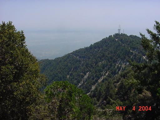
The many antenna on Mt. Wilson serving Los Angeles area
television viewers. There were so many strange looking antenna
that I couldn't help but wonder what aliens would think if they
saw this place!
|

|
|
Looking back towards Mt. Wilson from below Mt. Harvard.
Notice how steep the side of the mountain is: this is an example
of why you should never attempt to travel off-trail in the
San Gabriel mountains!
|

|
|
Along the Mt. Wilson fire road.
|
|
|
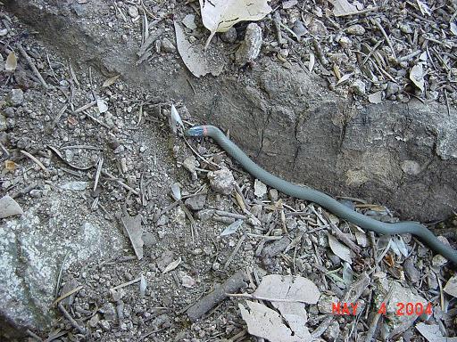
I never saw any rattlesnakes...
|

|
|
...but I did see this ring neck snake. About a foot long
and a quarter inch thick.
|
|
|
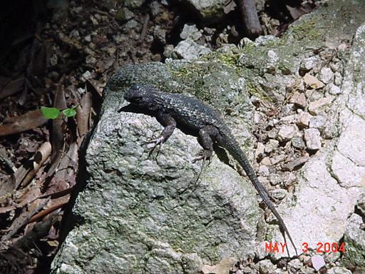
And I saw a lot of lizards.
|
|
|
Henninger Flats is operated by the Los Angeles County Fire Department.
It is one of my favorite places to camp as I really enjoy the view
at night. And I enjoy the coke machine! I hiked 12 miles today.
|
|
|
The view from Henninger Flats at night. Slightly obscurred by
smoke from fires in Riverside.
|

|
|
Eaton Canyon Nature Center as seen from Henninger Flats, 3.7 miles
away. This is where my hike would end and my sister would pick me up.
|
|
|
Looking towards Pasadena from the Mt. Wilson fire road.
|

|
|
Bad hair day. I have a picture of myself at this sign
(or the sign that preceded this one) taken in 1973.
|

|
|
Today's hike is only 3.7 miles, all downhill.
|

|
|
Me on the Mt. Wilson fire road.
|

|
|
Looking back to Henninger Flats from Eaton Canyon Nature Center.
|
|
|
Me at Eaton Canyon Nature Center 48 miles later.
|

|
My California hikes
My home page
Copyright © 2004 by Bill Qualls.
Last updated May 6, 2004.
|