|
Approaching Delaware Water Gap from the east, the "Gap" is clearly visible.
Driving westbound on I-80, Mt. Minsi is to my left.

This map is on the bulletin board at the parking lot.

My route is shown in red. The text in the box reads "Appalachian Trail
to Mt. Minsi This white-blazed trail can be started at Lake Lenape parking
area off Mountain Rt. in the town of Delaware Water Gap. The trail climbs
2 miles and 1,060 ft. to the top of Mt. Minsi. Mt. Minsi Fire Road
This dirt road climbs 1 1/2 miles and 1,060 ft. to the top of Mt. Minsi.
The road forms a 4-mile loop with the Appalachian Trail."

This is my first time on the Appalachian Trail. The locals probably take
it for granted, but I am so excited to be here. I wonder how many people
have walked where I am walking.

Eureka Creek. I know it sounds corny, but I wonder how many hikers have
filled a water bottle here.

Comfortable grade, pleasant walk.
Kittatinny Point on the Delaware River as seen from Lookout Point.
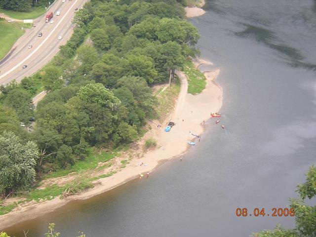
Kayakers at Kittatinny Point as seen from Lookout Point.
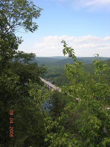
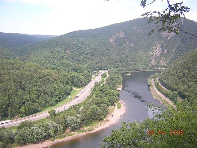
I-80 as seen from Lookout Point.
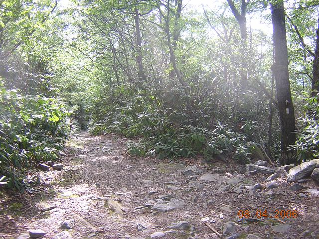
At this point the trail crosses the fire road (which is hardly
a road.) Note the AT sign and traditional white blaze on the tree
marking the trail.

OK, this sounds corny too, but I found this perfect campsite just a few
yards from the summit of Mt. Minsi, and I made a mental note of it,
hoping that someday I will camp here.

...and someday I'll enjoy the stars while sipping a cup of hot chocolate
warmed over a small fire here. (These dreams are what keep me going!)

Mt. Tammany as seen from Mt. Minsi. I hope to climb that before I leave
New Jersey.

Rhododendron is everywhere.

The Delaware River at Kittatinny Point, with Mt. Tammany in the background.
|