On Wednesday, May 23, 2001, my sister Ida dropped me off at the
Eaton Canyon Nature Center in Altadena, California. She picked
me up 72 hours and 54 miles later at Crystal Lake. This is the
story of my hike.
Bill Qualls (age 44)
|
|
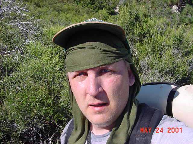
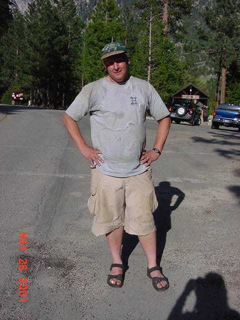
This is me at the nature center parking lot. My first
camp would be at Henninger Flats, which is three miles
away and can be seen in this photo as the cluster of
pines immediately over my head. |
 |
|
You hike up canyon within the bounds of the nature
center for about a half mile before reaching the old
Mt. Wilson Toll Road. I was only about a quarter of
a mile from the parking lot when I saw this beautiful
gopher snake. He (she?) wasn't too concerned about me.
I set my one liter water bottle down next to him so
you could get a better idea of his size.
|
 |
|
Isn't he handsome? After a full minute and several
pictures, he decided to retreat into the bush behind
him. I was surprised at how fast he moved once he
decided to do so! |
 |
|
I thought this rock was geologically interesting
so I asked a passerby to take a picture of me
in front of it. It's almost 7 p.m. and it's still
warm. The route to Henninger Flats is entirely
uphill, so I'm sweating already. Just a preview
of things to come... |
 |
|
Many of the plants were covered with this yellow
plant: they had the appearance of being attacked
with a can of "Silly String." |
 |
|
Here's a closer look. I took a picture so I could
find out what this is, but as I was doing so a
passerby told me it is called "Yellow Dodder".
It's some sort of parasite, like mistletoe?
|
 |
|
I have long enjoyed the hike to Henninger Flats,
even though it is uphill all the way and the trail
is really a dirt road. I did this hike several
times as a Boy Scout and it brings back pleasant
memories. Tonight I enjoyed watching the sun
set. |
 |
|
Getting closer...the cluster of pines marks my
destination. |
 |
|
Looking down...the long parking lot in the center
of this photo is the nature center where I
started. |
 |
|
I like yuccas. I hope you do too as there are
several pictures of them on this page! The next
two photos were taken at the same time and I
couldn't decide which one I like best, so I've
included both of them. This one was taken WITH
a flash... |
 |
|
...and here's a picture of the same yucca taken
at the same time but WITHOUT a flash. Which one
do you like best? |
 |
|
It was dark by the time I reached Henninger
Flats. There are several benches at a spot which
overlooks the basin. It was a clear night and
there was no one else camping there, so rather
than set up my tarp, I just slept on my poncho
at that spot. I don't sleep well, even at home,
and tend to wake up many times at night. From
this point I could enjoy the view each time I
woke up. You can hear dogs barking and police
and fire siren wailing. Not exactly a wilderness
experience, but nevertheless somewhat surreal
and enjoyable. |
 |
|
This is my bed the first night. I had decided
that I would not bring a tent on this trip.
I brought a tarp which I would use for rain if
necessary. But there was not a cloud in the sky
the entire time I was out. I never did set up
the tarp. I slept out in the open every night.
This was a refreshing change from tenting.
|
 |
|
This is me the first night. Notice the photon
LED flashlight on the retractable lanyard. This
was the first time I used this. I HIGHLY
RECOMMEND IT! Clipped to the collar of my t-shirt,
it was always accessible, but never noticeable.
|
 |
|
The next morning I continued up the road towards
Mt. Wilson. This is the view of Henninger Flats
from above. This area was burned in a fire many
years ago. The open area in the center of this
picture is where the campground was when I was
a Boy Scout. |
 |
|
I saw this quail on the road to Mt. Wilson.
|
 |
|
It is 6.3 miles from Henninger Flats to Mt.
Wilson. It is uphill every step of the way,
for a total elevation gain of 3,078 feet.
|
 |
|
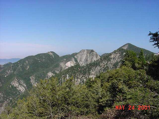
Almost there...this is the view looking east.
If you are unfamiliar with the San Gabriel
mountains, this picture gives you an idea of
how rugged they are. |
 |
|
About a half mile from the top, there is a
small trail which leaves the road, but pretty
much parallels it. I decided to take this
trail since I had never taken it before.
This was a mistake, for although the trail
is in good condition, these caterpillars were
hanging from the scrub oaks all along the
trail. I probably walked through their webs
a hundred times before I reached the top.
By the time I got to the top I felt very
dirty, being covered in sweat and these webs,
so I found a water faucet and gave myself
a sponge bath. |
 |
|
Here's a view from the top looking into the
upper reaches of Eaton Canyon. |
 |
|
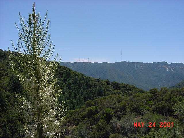
Here's a view of the antennas on Mt. Wilson.
Mt. Wilson still has a working observatory
but it's location makes it ideal for all of
the television station antennas for the
Los Angeles area. By now you may be thinking
"that's not wilderness" but I assure you that
this will change quickly! |
 |
|
Another view from Mt. Wilson. This is looking
west towards (I think) Mt. Lowe and Mt.
Markham. |
 |
|
I left Mt. Wilson, descending the Kenyon Devore
trail down Strayns Canyon. (This trail begins
where the highway leading to Mt. Wilson splits
into two one-way roads.) This trail goes to
West Fork campground. It is seldom used as there
is little reason to hike it: West Fork campground
is not as popular as it once was, and there are
other routes up Mt. Wilson. As I began my
descent, I thought that it was a lovely trail.
It is shaded all the way (rare in the San
Gabriels!) and generally in good repair (no
washouts, etc.) But after a short distance I
began to encounter many downed trees. The trail
was often blocked. Here's just one example.
I later discovered that at one of these points
I had torn my sleeping pad. I was glad that
I use an inexpensive closed cell foam pad and
not one of the more expensive self-inflating
pads! |
 |
|
If the obstacles were cleared, this would be
a pleasant trail to hike. There are several
cascades along the way. |
 |
|
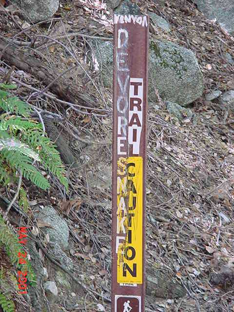
The Kenyon Devore trail meets the Gabrielino
National Recreation trail about a mile upstream
from West Fork Campground. Here I saw this trail sign
which greets hikers wishing to ascend the trail.
No wonder the trail is used so little! Rattlesnakes
are pretty common in these mountains: I don't know
why someone saw fit to warn hikers about this
trail in particular! The sign has actually been
modified. "DEVORE" was once "RATTLE" as this trail
was also known as the RATTLESNAKE trail. |
 |
|
This is the stream at West Fork Campground.
It's a beautiful stream, but I don't think the
campground is used too much anymore. At one time
you could drive to this spot, but I think access
by car is very restricted now. Several trails come
together here, but Devore campground
is only a mile downstream and hikers prefer to
use it. Three years ago a ranger told me that
bears were common at West Fork, and there were
warning signs about bears posted at the campground.
Maybe THAT is why the campground is seldom used!
By the way, West Fork campground is 4.8 miles from
Mt. Wilson, downhill all the way, for a total
elevation drop of 2,640 feet. But in the San
Gabriels, what goes down must go up...
|
 |
|
It was at West Fork campground that I first met
the Silver Mocassin trail. This trail is a popular
high adventure trail for Boy Scouts: it travels
53 miles from Chantry Flats to Vincent Gap. I would
be on the Silver Mocassin trail for the next 35
miles. The trail goes up Shortcut Canyon to the
Angeles Crest Highway at Shortcut Saddle, a total
of 3 miles and 1,800 feet elevation gain. It starts
off pleasant enough, but is long and steep and hot
in its upper reaches. I hate this trail every time
I do it. I usually see rattlesnakes on this trail,
but not this time.
|
 |
|
This is a view from the Shortcut Canyon trail
looking back towards Mt. Wilson.
|
 |
|
The trail crosses the Angeles Crest Highway at
Shortcut Saddle and descends into Big Tujunga
Canyon. Do you see the pattern yet? Long up,
long down, long up, long down. Welcome to the
San Gabriels! |
 |
|
Within Big Tujunga Canyon, the trail is fully
exposed to the elements. The crushed granite
surface makes it feel as though you are walking
in a reflector oven. I heard a rattlesnake
here, but did not see it. It was in a bush
on the side of the trail. Only a nut would be
out walking in this! |
 |
|
At Shortcut Saddle my thermometer read 95
degrees. Within Big Tujunga Canyon I watched
the temperature climb to 98 degrees, and then
to 105 degrees. All I can think about is water.
I drank nine liters this day. Food held no appeal.
You can see at this point that I am not amused!
|
 |
|
Finally, after 4 miles and a 500 feet drop in
elevation followed by a 1,000 feet climb, I reached
Charlton Flats picnic grounds. This is the view
back to where I came from: you can see the
antennas on Mt. Wilson in the distance at the left.
I have hiked 18.1 miles today.
|
 |
|
Charlton Flats is only a picnic ground but I
decided to make camp here. I found a picnic
table about 150 feet from the road and started
cooking some dinner. As my dinner was cooking,
I walked back to the road to deposit my trash
in the trash can, then returned to my cooking.
About five minutes later I heard a large
crashing noise - obviously the trash can. I
walked back towards the cans where I saw this
bear. I knew there were bears in the San Gabriels,
but this was the first time I had seen one here.
I have admitted to others before that I have what
I recognize to be a totally irrational fear of
bears. As such, I was surprised by my reaction
to seeing this bear: I wasn't afraid at all.
I guess I would rather see a bear at day than
hear a bear at night. I took this picture, then
yelled at the bear from a safe distance: I wanted
to make sure he knew I was there. (In retrospect,
I think this was rather naive, as I suspect he was
watching me cook. Why else did he show up so soon
after I had gone to the trash can?) He decided
to run, and I was amazed at how fast he ran. In
two bounds he was across the road and on his
way down the canyon on the other side. There
is no way anyone is ever going to outrun one
of these guys. (Of course, you should never
attempt to do so as this will trigger their
instinct to chase. But I'm sure that laying
down and playing dead is easier said than
done!) |
 |
|
I finished dinner then packed up to set up
camp some distance from where I had cooked.
I returned to the road and this coyote was
seeing if the bear had left anything behind.
The coyote was much less timid than the bear.
We exchanged glances for awhile, then he
slowly walked off.
|
 |
|
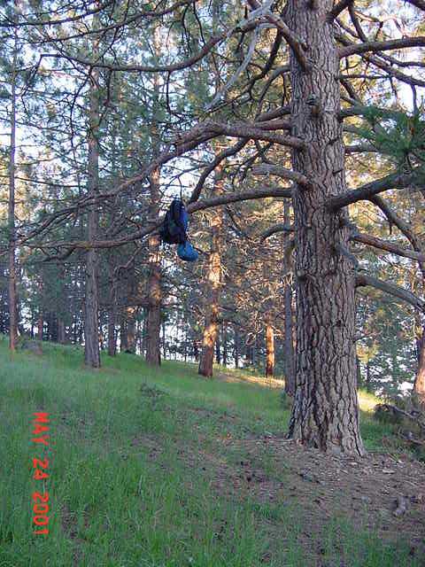
Having already seen a bear, I was careful to hang
my food in a tree. Then I laid out my poncho, pad,
and sleeping bag about a hundred feet away on a
thick bed of pine needles.
|
 |
|
The evening was very comfortable with a gentle
breeze: not cool, not warm, just right. But the
mosquitos were out thick. This seemed strange to
me as there had been no mosquitos at Henninger
Flats just the night before.
|
 |
|
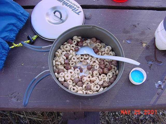
There was no water at Charlton Flats. A ranger
told me that the pipes were too old and that
they leaked so much that they just left the
water turned off. He gave me some water from
his truck. I arose the next morning and decided
to hike the three miles to Chilao campground
before eating breakfast as I knew there was
water available there. For breakfast I had
my standard fare of cheerios and cocoa puffs.
I also drank plenty of water.
|
 |
|
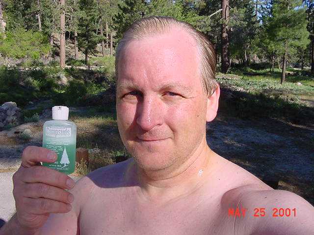
Chilao is a popular campground for car campers.
Given as there was piped water here, I decided
it was time for a much needed bath. For a brief
moment, I felt like a million bucks! That feeling
would fade as soon as the sun got higher.
|
 |
|
I left Chilao and continued on the Silver
Mocassin towards Bandido campground. Shortly after
leaving Chilao I saw this bear track.
|
 |
|
I really like this portion of the trail
between Chilao and Bandido. There are several
small but scenic meadows here. Meadows are
rather unusual in the San Gabriels.
|
 |
|
I know I look awful here: it took a lot of
confidence to post this picture! I did so
because I wanted to show this sign. This is
one of the old Silver Mocassin trail signs.
It is the only such sign I saw during the 35
miles I spent on that trail. I think this is
an original, and probably pre-dates my time
in scouting. I will guess this sign dates
back to the late 1960s. Can anyone out there
confirm this?
|
 |
|
The trail crosses the Angeles Crest Highway
again at Three Points. This is also where the
Silver Mocassin Trail joins the Pacific Crest
Trail. The Pacific Crest Trail goes from Mexico
to Canada through California, Oregon, and
Washington. I would now be following the Pacific
Crest Trail for the next 21 miles.
|
 |
|
The trail from Three Points to Cloudburst
Summit is four miles of uphill, skirting
Mt. Waterman. This spring - not mentioned in
the trail guides - was a welcome surprise!
|
 |
|
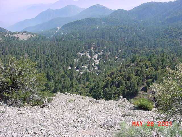
I have always loved the view from the northern
side of the San Gabriels towards the deserts
below.
|
 |
|
Another view of the deserts from the side of
Mt. Waterman.
|
 |
|
The trail crosses the Angeles Crest Highway
three times enroute to Cloudburst Summit. The
trail then drops about 800 feet over 2 miles
to reach Cooper Canyon trail camp.
|
 |
|
I don't particularly like hiking alone, but
I'd rather hike alone than not hike at all.
For safety, I had left a written hiking plan with
my sister. I also carried a cell phone, and
checked in with her periodically so she could
update that plan. One suggestion I got from a
survival forum on the internet was to use crepe
paper to mark my route. If I turned up missing
and a search was done, this would help to narrow
down the search area. Crepe paper is much more
environmentally sound than using surveyors' tape,
which is permanent. Crepe paper will disappear
after a few rains, or be gathered by birds to
line their nests. This one says, "BQ here
Friday @ 3:00. Going to Eagles Roost. Remove
after 5/31/01. Thanks."
|
 |
|
This is Cooper Canyon trail camp. It is a very
nice camp, and I have stayed here a number of
times before. And although I had already gone
12 miles today, I decided to continue hiking.
I would have stayed here if there were other
campers here that I could talk to, but the place
was empty. You see, I like to hike, but I don't
particularly like to camp. I thought to myself,
"It's only 3:00. It won't be dark for five
hours. I won't go to sleep for seven hours.
What will I do for the next seven hours?"
My biggest fear is that others will find me as
boring company as I find myself.... I put down
two liters of water and continued on.
|
 |
|
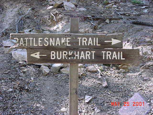
Isn't this a cool sign? I think it has
character! I've hiked the Rattlesnake trail
about half a dozen times and have never seen
a rattlesnake there (though I think you can
find rattlesnakes just about anywhere in the San
Gabriels.) This trail is in very good condition
and quite scenic. It is 1 mile from Cooper
Canyon to the Rattlesnake trail, then four
miles (uphill, of course) to Eagles Roost
picnic ground.
|
 |
|
Scenery along the Rattlesnake trail.
|
 |
|
I should have camped at Eagles Roost picnic
ground, but exercised poor judgment here.
I have always enjoyed the view from the top
of Mt. Williamson and decided to continue on
to there despite having already gone 18 miles
today. It would have been wise to cook dinner
first, but there probably wasn't time to cook
and hike. It's 1500 feet elevation gain over
three miles from Eagles Roost to the top of
Mt. Williamson. When I started the ascent I
was moving pretty slow, and having problems
with cramping. This is a view into the depths
of Bear Canyon from about half way up Mt.
Williamson. (Note: there are two Bear Canyons
in the San Gabriels.)
|
 |
|
I reached the peak of Mt. Williamson at about
8 p.m., hiking the last, steep, quarter mile
by moonlight. I had hiked 21.1 miles with an
elevation gain of about 5100 feet. I was totally
exhausted. My legs and stomach were cramping despite
drinking plenty of water at every opportunity.
When I took my pack off, my wet back chilled from
the breeze. In no time at all I was shivering!
I've had enough survival training to know that
shivering is a very serious thing: I am more
afraid of shivering than I am of bears! I knew
I was in danger of hypothermia. My body was
depleted. I probably hadn't eaten more than 1,000
calories today, but had probably burned up 8,000
to 10,000. I needed to get warm fast! I pulled
off my wet shirt and put on a fleece sweater,
then a wind breaker. I found my stocking cap and
covered my head. I was still cold. It seemed as
though my body simply didn't have enough calories
to produce any heat. I tried to set up my poncho,
pad, and sleeping bag. I snapped the sides of
my poncho together and stuffed the pad and sleeping
bag inside. I was afraid that if I didn't do this,
my sleeping bag and/or pad might blow away in the
wind if I walked away from them such as to urinate.
But getting in the bag was tough. When I stood, my
stomach would cramp. When I layed down, my legs
would cramp. I finally settled in, still shivering.
Dinner was a piece of beef jerky and some koolaid.
I called my sister on the cell phone to let her
know where I was and that I was OK. I needed to
tell someone that I was OK. And eventually I was.
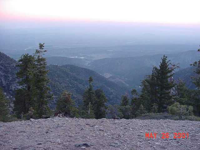
This picture is the sunrise the next morning,
looking towards Victorville. |
 |
|
The view from Mt. Williamson towards South
Fork campground and the desert.
|
 |
|
My pack at the top of Mt. Williamson. This
is where I slept. I woke early and began the
descent to Islip Saddle.
|
 |
|
Here's something I had never seen before. There
were three letters placed along the trail between
Mt. Williamson and Islip Saddle. They were from
"Mr. McKinney's 6th Grade Class". They were
letters of encouragement to Pacific Crest Trail
hikers. They were laminated, then simply placed
under rocks along the trail so the hikers would
see them. I neglected to write down the first
one, but here's the second one I found. In case
you can't read it, it says "I hope you never
give up. When I was 7 I cut my head open. I
thought I was going to die but I didn't give
up. And you should never give up. Like a bike if
you fall off you have to get back. If you can
give a little more effort you can go a long way.
I hope you can do your best. happy trail."
|
 |
|
And here's the third one which you can read for
yourself...pretty funny!
|
 |
|
When I reached Islip Saddle there was a gentleman
there waiting to greet his son's scout troop.
They were camping at Cooper Canyon (so I wouldn't
have been alone afterall. They were only a few
hours behind me.) He couldn't be with them because
he had broken his leg a few months earlier while
skiing. Anyway, he took my picture here.
|
 |
|
At Islip Saddle I crossed the highway and
continued on towards Little Jimmy trail camp
(a 700 foot elevation gain over 2.1 miles). This
picture was taken about a half mile from Islip
Saddle looking back to Mt. Williamson where I
had spent the night. |
 |
|
I thought it comical that I should see snow on
the trail when just 36 hours earlier I had been
hiking in temperatures of 105 degrees! The San
Gabriels really are remarkable.
|
 |
|
I neglected to take pictures of Little Jimmy
trail camp, and that is unfortunate as it is,
in my opinion, one of the jewels of the San
Gabriels. I had made up my mind that I would
stay at Little Jimmy for awhile and eat. I
needed to get some calories inside! I had four
cups of hot chocolate and two Clif bars. I still
didn't feel like eating. I rested there for
three hours, putting down three liters of fluids
while visiting another member of the LDS church,
a cop from Rialto. At noon I decided to try
for Mt. Baden Powell, 6 uphill miles away.
Resting, eating and drinking was the right thing
to do: I felt pretty strong as I continued past
Windy Gap and towards Mt. Baden Powell. There
are many spectacular views towards the desert
along the way, such as this one.
|
 |
|
Isn't this pretty? Elevation about 8,000 feet.
|
 |
|
Finally, the trail crosses a small pass near
Throop Peak and you are rewarded with your
first view of Mt. Baldy.
|
 |
|
Shortly thereafter, you get your first view
of Mt. Baden Powell, elevation 9,399. However,
at this point I was starting to feel weak again.
I simply wasn't eating enough. I had plenty of
food with me, but I had no interest in eating.
With two miles to go, at four o'clock I decided
I didn't want a repeat of last night (camping
on the mountain top) and exercised what I believe
to be uncommonly good judgment for me, and
decided to turn around and return to Little
Jimmy. I wanted to go to Baden Powell, but I've
been there before and there will be other
opportunities. But not this time.
|
 |
|
On the return trip. Isn't this beautiful?
It was now Saturday at 4:30pm, and I had arranged
for my sister to pick me up at Crystal Lake on
Sunday at 3:00pm. But Crystal Lake is only about
3.5 miles from Little Jimmy. I saw little point
in sticking around till then (boring, remember?)
so I called her on the cell phone and asked her
to meet me at Crystal Lake tonight at 6:00pm
instead.
|
 |
|
This is looking down towards the Crystal Lake
campground from near Windy Gap.
|
 |
|
Here's the "after" picture, taken at Crystal
Lake. My pack had been pushing down my pants,
and they were bunching up around my ankles.
At one point I almost tripped myself on them,
so I cut off the legs. My feet held up
well, with only one small blister on one toe.
I was ready to go home. It was a very loving
sister who let a very stinky brother into her
nice car! I had hiked 54.3 miles in 72 hours,
including a total elevation gain of 14,600
feet. We stopped at Del Taco on the way home
and I had 2 Macho Combo Burritos. I should
have carried those with me on the hike!
Yummy! You know, it's always the same thing:
I'm always glad to get home, but once I get
a bath and a burrito, I can't wait to get
back out again!
|
 |
|
Be sure to tune in next year for
"Bill's
Midlife Crisis - 2002 Edition - The Saga
Continues."
|
My California hikes
My home page
Copyright © 2001 by Bill Qualls.
Last updated June 8, 2001.
|