|

The adventure begins. Joseph Larson, Bill Qualls, Shane Seay.

This is the first time Shane and Joseph have been to
California, and their first real attempt at backpacking.

Just a mile or so into the hike we stop for water at a spigot next
to forest service residences. Staying hydrated will prove to be a constant
concern on this hike.

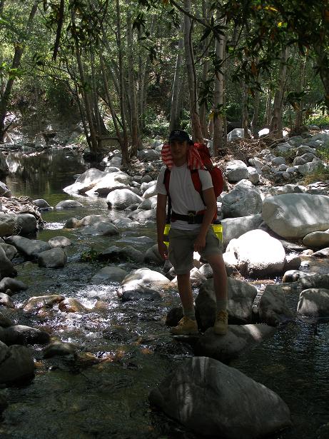
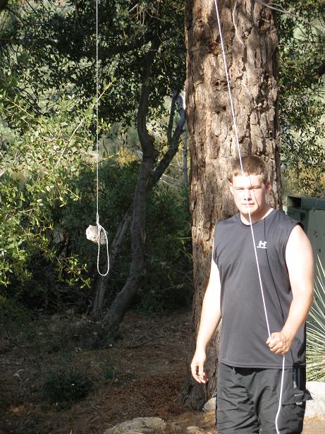
Shane's first time crossing a mountain stream.

The swim hole at Gould Mesa is a favorite.

Joseph at the Gould Mesa swimming hole.

Bill swimming. "There's no place like home..."

Heaven. I savor the moment.
I've hiked this route enough to know it's about to get real hot.

Joseph and Shane at the agave patch just beyond Gould Mesa.
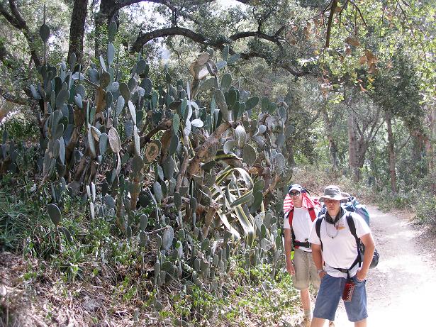
Joseph and Shane at a large cactus patch between Gould Mesa
and Paul Little picnic area.
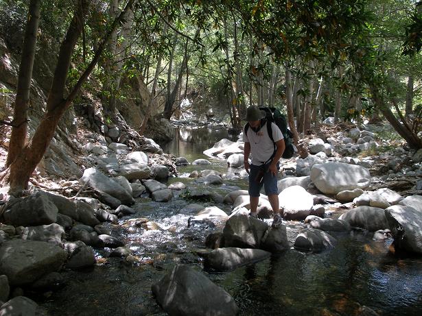
Joseph crosses the creek yet again in the Arroyo Seco.
What a pleasure to be here.
Shane navigates the rocks.
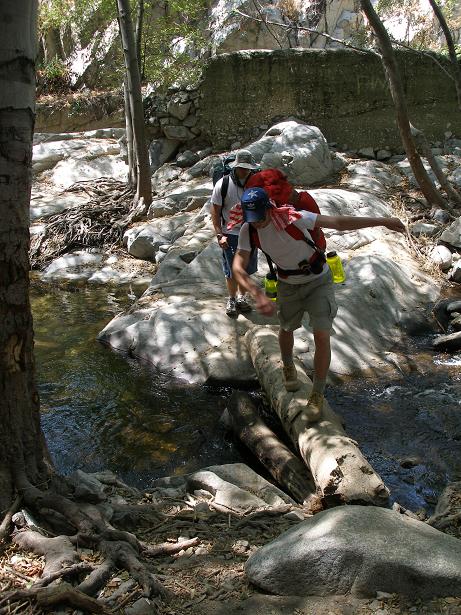
Another creek crossing below Paul Little picnic ground.
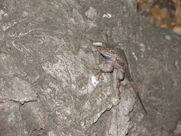
Blue-belly lizard at Paul Little picnic ground.
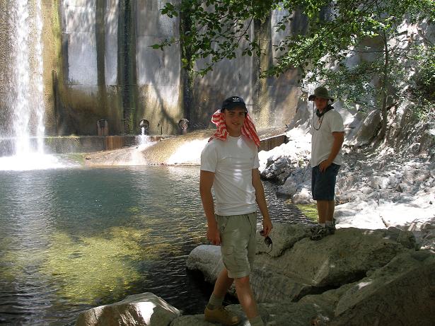
Joseph and Shane at the dam just past Paul Little.

Joseph and Shane at Paul Little picnic ground.
Just past Paul Little there is a short but steep climb.
It is a dose of reality; a taste of things to come.
Doing real well so far.

Where did the water go?

This stuff is gross.

For a first-timer, Joseph proves to be a strong outdoorsman.

We stop for lunch at Oakwilde campground.
Ramen soup (salty) tastes sooo good.

This cool tree is at Oakwilde campground.
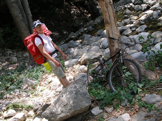
Just past Oakwilde campground we found this abandoned bicycle.
Farther up the trail we found the abandoned bicycle seat!
The first of several places we will come to where the
trail has eroded away.
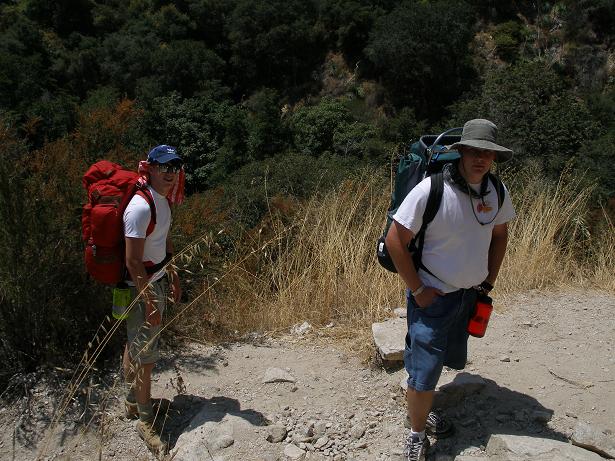
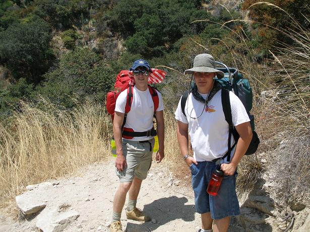
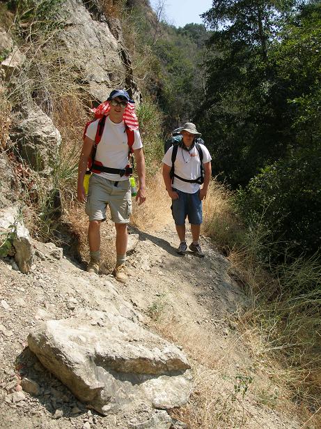
Joseph and Shane on the trail between Oakwilde and Switzers.
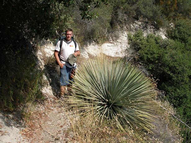
The largest yucca Shane has ever seen.

Joseph just keeps on chugging. Wrestling and track served him well.
Ah, to be so young again....
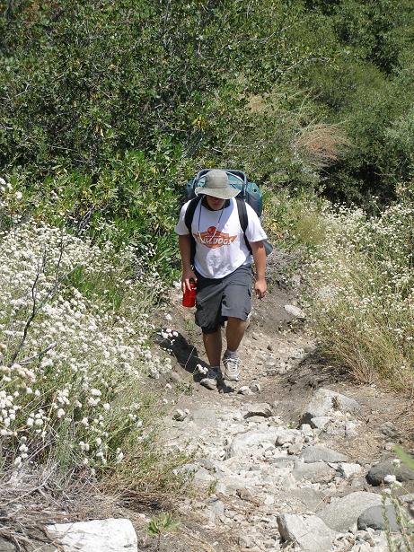
The trail between Oakwilde and Switzers is a long uphill climb
and it can take its toll, but Joseph is up for it.

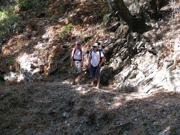
Classic San Gabriel mountains trail shot.
We came up this valley.

The worst is over for today.

Trail sign at the fork for Oakwilde, Switzers picnic ground
and Bear canyon. We will now descend into Bear canyon and check out
Switzers Falls.

Bummer...these large trees have pretty much filled up my
favorite swimming hole. I wonder how long they will be there?
Will a flood take them out? Recognizing they represent a hazard to
swimmers, will the Forest Service remove them?

We camped about a half mile downstream from Switzer Falls.
We didn't use tents: we each had a "sleep screen" which provided
protection from the bugs. We had no rain throughout this trip.

The next morning, on the trail to Switzers picnic ground.

We saw this helicopter at Switzers picnic ground.
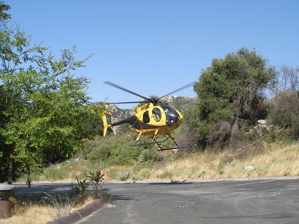
Helicopter at Switzers picnic ground.

Helicopter at Switzers picnic ground.

The trail from Switzers picnic ground to Red Box station
is uphill and hot. We took a rest beneath a large coulter pine
and Joseph and Shane had their first exposure to the massive
coulter pine cones. You don't see these in Illinois!
Shane on the trail between Switzers picnic ground and Red Box station.

Joseph's heels prove to be the kink in his armor. He had some blister
problems. Here we've covered his blisters with some duct tape (not as
ridiculous as it may sound.)

Check out the background. The San Gabriels are very rugged.
But then, so is Joseph.

The view from Red Box station. We came up this canyon
from Switzers picnic ground,
the trail paralleling the highway. The Native American museum at
Red Box station was open and I took advantage of the available
Coca Cola. We had lunch and rested at Red Box before continuing
on to Valley Forge campground.

We followed the road down, down, down from Red Box station to
Valley Forge campground. You hate to lose altitude in the San
Gabriels because you know you're going to have to climb back
up again!

Welcome to Valley Forge campground. There were probably
50-60 people camped here but we found a relatively private spot
to set up camp.

When we set up camp, it appeared as though we might get some rain,
so we got the rain fly ready just in case, but it wasn't necessary.

The next morning we woke and continued our hike. The first leg was
from Valley Forge campground to West Fork campground.

At West Fork campground we would leave the Gabrielino trail and take the
Silver Moccasin trail. This next segment - Shortcut Canyon to Shortcut
Saddle - is always tough. It's uphill and exposed. It's always hot.

There is a spot in the lower part of Shortcut Canyon where the trail
has fallen away. So you have to go down to the creek, around the slide,
and back up to the trail.

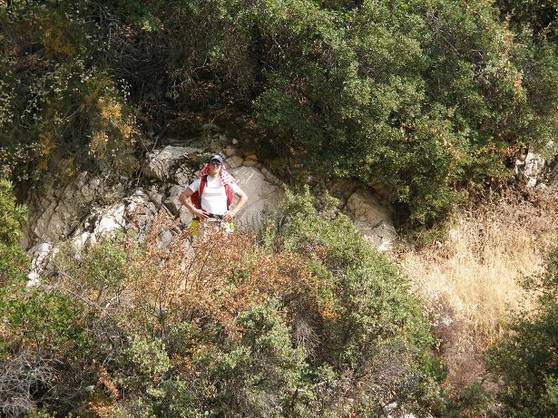
One of very few pictures of yours truly. I am drinking water and
Gatorade like crazy, but I just can't cool down. I am so sweaty.
It is sooo hot.

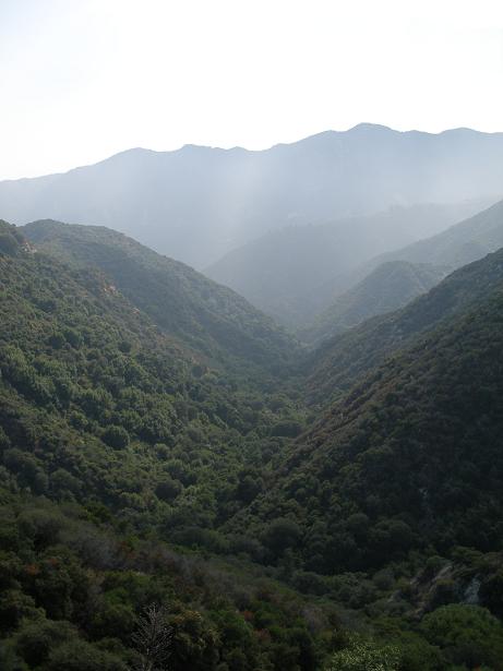
Looking back towards Mt. Wilson. Our hike started on the
other side of that mountain. We didn't go over it: we took the long
way around it.

Shortcut Canyon trail.

Joseph just below Shortcut Saddle.
Joseph just below Shortcut Saddle.

Shane and Joseph at Shortcut Saddle. Here's where it gets
really tough. You go down, down, down again and then
up, up, up to Charlton Flats picnic ground. It isn't as difficult
as Shortcut Canyon, but it feels worse because it is after
Shortcut Canyon so you're tired before you start.

Another water stop from a trickle of a stream between Shortcut
Saddle and Charlton Flats picnic ground.

Our rest stops are becoming more frequent. The heat is taking
its toll on me. I'm wondering if it is due to the medication
I started this year. What are all those warnings about avoiding
direct exposure to sunlight? I've had a whole lot of exposure!
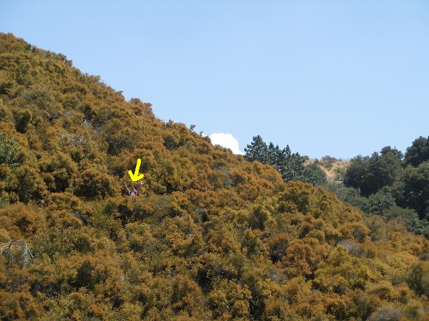
I am always so excited when I get to Charlton Flats as it is
breezy and cool and the pines are beautiful. But not this
time. The picnic ground is abandoned. The forest appears dead.
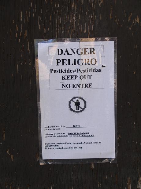
There are downed trees everywhere. And then I see this sign. At
this point I am so exhausted from the heat and frustrated by what
I am seeing that I am thinking we may cut this trip short.
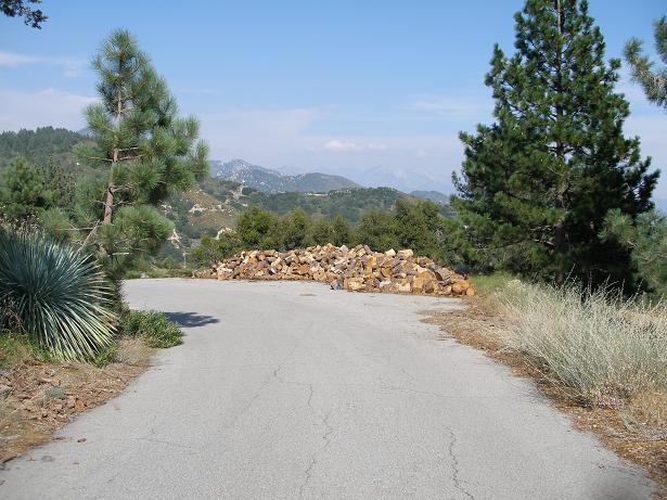
Due to the pesticide sign, I decide we will take the most direct
route out of this picnic ground. We follow the road to the Angeles
Crest highway. There are downed trees and piles of firewood everywhere.
It breaks my heart.

I think the ranger station at Charlton Flats has been closed for
years. The water at the ranger station has been turned off.
We are almost out of water, so I start flagging down cars asking
for water. Most people are happy to stop and help and share their
water.

This dear woman gave us water, then asked if we wanted her to drive
back up the road to a restaurant and bring back some burgers. I couldn't
believe her generosity. I give her $20 and she takes off. She comes
back a little later with a bag of food and drinks and says "The receipt
is in the bag just so you know I didn't rip you off." And then off
she goes. I find the receipt...for $31. This is what hikers refer
to as a "trail angel". Thank you, ma'am. God bless you.

Yummy!
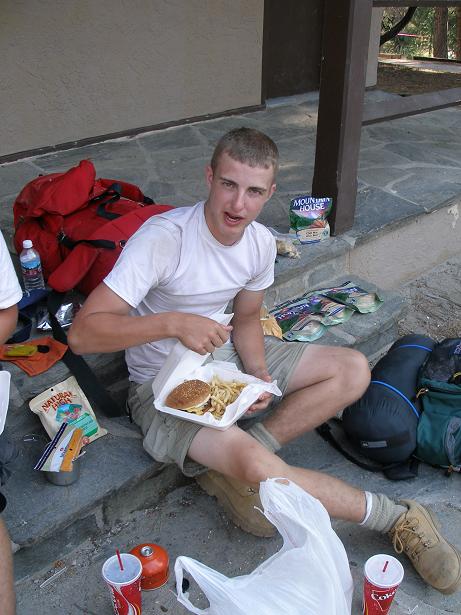
The burgers and fries are so much better than the freeze dried dinners
we were planning on cooking (behind Joseph.)

We hike three miles on the highway from Charlton Flats to Chilao
campground.
I have absolutely nothing left.

We will spend our third night at Chilao campground.

Joseph's blisters are bothering him. And the heat is affecting
me worse than it ever has. Is it my medication?
We decide to call it quits, a decision
which will plague me for a long time. I call my sister Ida and
she will come tomorrow night and take us home.

Our campsite at Chilao. Shane says it feels good to be in bare feet.

Good morning, sleepy head.

We've got a day to kill here. So Shane and Joseph decide to harvest
some Coulter pine cones.

Shane, back from the hunt.

While the boys hunt coulters, I nap. I take several
short strolls throughout the day. I am exhausted. I know
quitting was the right thing to do, but it nags at me constantly.
I had such high hopes for the boys for this trip. The feeling
that I may have let them down only serves to bring me down.

Joseph admires his beard.

I win.

Hi Shane.

"You're mine!"
The hunter shows his technique.

Jack rabbit at Chilao.

Joseph gets overly ambitious!

Trophies from the days hunt.

One good thing about ending the hike early is the boys had
another chance to visit the ocean before flying home. This
is Joseph and Shane on the Newport pier.

White boy on Newport pier.

Too cool for Illinois.
"I'd take a job as a hit man if I could live like this!"
(Note to Stacee: I think he's kidding, but I can't be sure.)

There were a lot of jellyfish this year.

Jellyfish as seen from the Newport pier.

Bill and Shane get an Italian ice on the walk at 15th street.

This home on the walk has a beautiful garden.

Joseph and Shane said "Bishop Coleman would love this!"

Another advantage of ending our hike early was a chance to attend
the open house for the Newport Temple of the Church of Jesus Christ
of Latter-day Saints.

Joseph at the Newport LDS temple open house.

Shane at the Newport LDS temple open house.
|