Much of the hills adjacent to Whittier and La Habra are now set aside as a nature preserve. So trails which were once the domain of rogue cross country runners are now legitimately open to the public. I couldn't be more pleased! This was my first time walking in these hills since I was one of said runners about 35 years ago. This hike was with Wendy, an acquaintance from high school who has become a good friend since last year's class reunion.
We parked the car on Fullerton Road, just a couple hundred yards south of Harbor Blvd. Our route took us on the Black Walnut trail (1.0 miles) to the Powder Canyon trail (0.6 miles) to the Schabarum trail extension (aka the Juan Bautista de Anza National Historic Trail Recreation Route) (2.7 miles) to Harbor Road to Fullerton Road to the car (0.2 miles), for a total of 4.5 miles.
No, it's not wilderness. But it's a great way to spend an evening. I am just glad to know it is there, and if I lived here I would certainly take advantage of it on a regular basis. There are many more miles we could have hiked if we had had more sunlight. For more information and downloadable topo maps see the home page of the Puente Hills Landfill Native Habitat Preservation Authority at http://www.HabitatAuthority.org. Go here for report of another hike in the same preserve.
A tip for other hikers: there are roads on the ground which do not appear on the map. There are also other roads on the ground which appear very faintly on the map. This area is, in fact, a good place to learn to read a map. Although the high power lines detract from the scenery, they are your best landmark for determining where you are on the map.

#0. Our route.

#1. The Black Walnut trail is a pretty steep climb as you leave Fullerton Road. But after that initial ascent, the route is reasonably graded.

#2. Wendy humored me by posing for a couple of photos.

#3. The foliage in the area is quite dense. It's easy to see how fires in the area can spread so rapidly. Look how dry it is -- and this is the end of December!
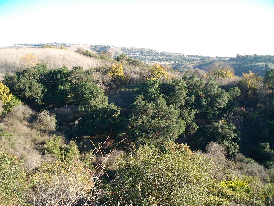
#4. There are some large stands of canyon oak.

#5. The high power lines are an unfortunate reality here. But I still love it.

#6. Toyon.

#7. A close-up shot of toyon, sometimes called Christmas bush because its red berries ripen this time of year.

#8. The trees formed an archway over portions of the Black Walnut trail.

#9. Another view of the tree archway.

#10. More dense growth in the rolling landscape.

#11. This was a most curious plant. Two plain round leaves, and two spotted pointed leaves. I didn't know what it was, but someone later told me that it is milk thistle.

#12. More milk thistle.

#13. Milk thistle is extremely invasive. It is also edible. Seems to me you would be doing the environment a favor by feasting on the young plants (but not the prickly part!)

#14. A scene from the Powder Canyon trail.

#15. A canyon oak as seen from the Powder Canyon trail.
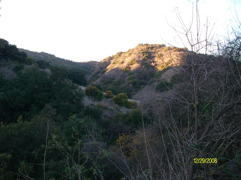
#16. Many of these canyons are really quite inaccessible off trail.

#17. Self explanatory.

#18. Visible sedimentary rock with evidence of significant upheaval.

#19. On the Schabarum trail extension, aka the "Juan Bautista de Anza National Historic Trail Recreation Route" (that's a mouthful.)
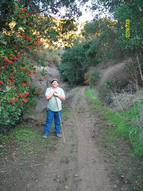
#20. Me. Next to toyon bush.

#21. More trail footage. This trail had a nice grade.

#22. Wendy briefly forgetting other stuff.

#23. Looking north towards Azusa Road.
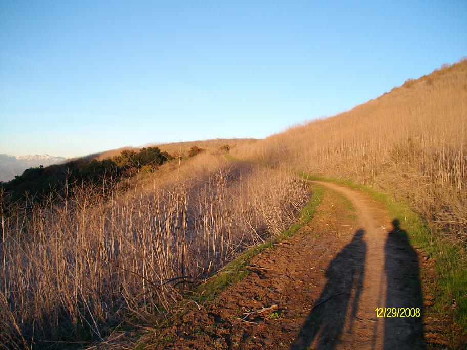
#24. The low sun made for less than perfect photos, but also perfect hiking.

#25. My friends, the San Gabriels mountains.

#26. More San Gabriel mountains. These pictures don't do the view justice.

#27. Not very clear in these photos, but clear in person, were Mt. San Gorgonio and Mt. San Jacinto.

#28. A couple of personal favorites.

#29. Almost done. Next stop...Shakey's Pizza.
Copyright © 2008 by Bill Qualls. Last updated Dec 31, 2008.
Back to my survival page.