This will likely be my last outing for this vacation. Time for some solo dirttime. I hiked from Chantry Flats to DeVore trail camp, about 7.5 miles each way. I had planned to spend two nights at DeVore, but one night was enough. I needed to face some of my demons, and I did so. I was pleasantly surprised with how I held up to the hiking, but my apnea made for a very restless night and I couldn't see the point in going through that part again. It was a nice trip. First week of January, and I hiked both ways in shorts and a t-shirt! I love Southern California!

#0. I was tired when I started this adventure, as I had already traveled to infinity and beyond the previous day.

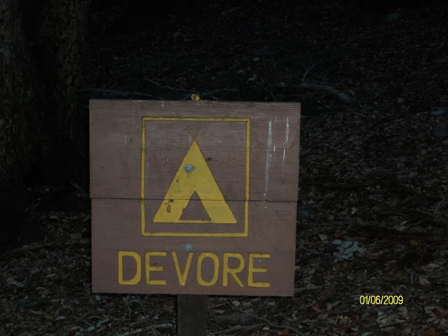
#1. My destination was DeVore trail camp, which is about 1.5 miles the other side of Newcombs Pass. It's about 6 miles from Chantry Flats to Newcombs Pass. The pass is barely visible from Chantry Flats. I am not 100% sure where the pass is, but I think the arrow points to it.
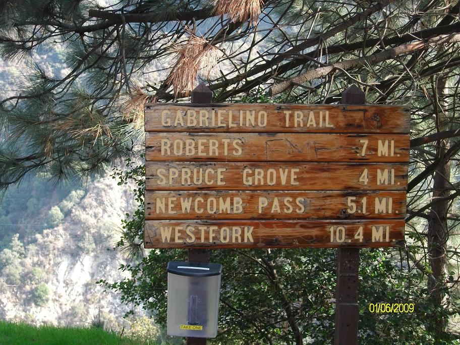
#2. I don't know why I always feel compelled to take pictures of trail signs, especially when I know they are wrong! For example, it's at least two miles from Spruce Grove to Newcombs Pass, maybe two and a half.

#3. Well, that's part of what this trip is about. "...and may you like what you find."

#4. Roberts camp (site).

#5. Another trail sign...if you do the math, it's 3.7 miles from Chantry Flats to Spruce Grove, though the previous sign said it was 4 miles. So why do I even bother taking pictures of these signs? I don't know....
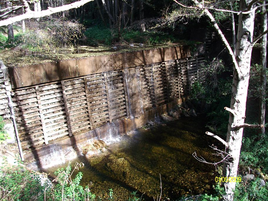
#6. One of the many flood control (?) dams built in a less-enlightened era.
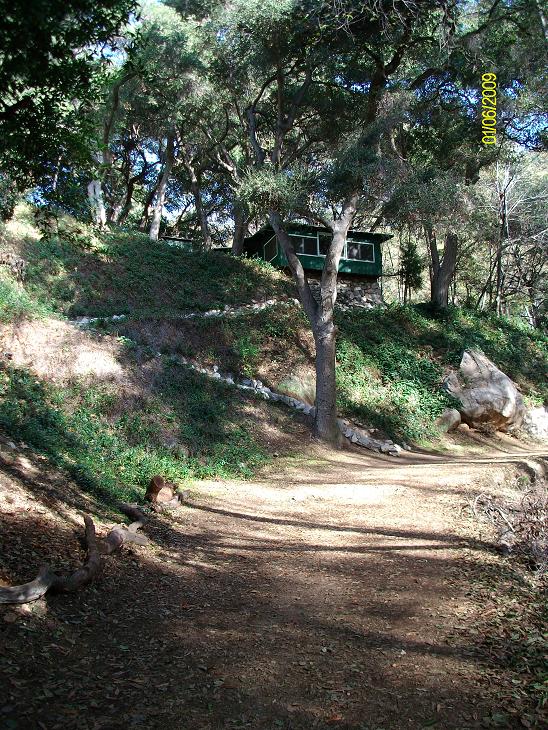
#7. The route follows what is mostly a dirt road up Big Santa Anita Canyon. The canyon has many small cabins which are leased by the Forest Service. I've wanted one of these since I first saw this canyon 41 years ago.

#8. This cabin has what appears to be a very comfortable screened porch. I'll bet it's great for sleeping in the summer.

#9. Stream side trail.

#10. I am particularly drawn to those cabins which extend just slightly beyond their foundations. Kinda like myself.

#11. Another trail sign. Feel free to ignore.
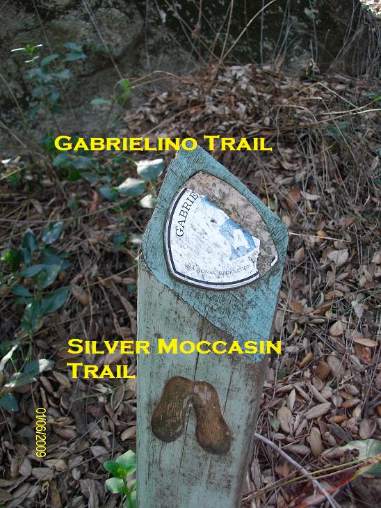
#12. This route is part of the Gabrielino trail, which goes from Chantry Flats to Altadena via Red Box, and the Silver Moccasin trail, which goes from Chantry Flats to Vincent Gap.

#13. It is a beautiful day.
#14. I love these trailside chaparral shots.
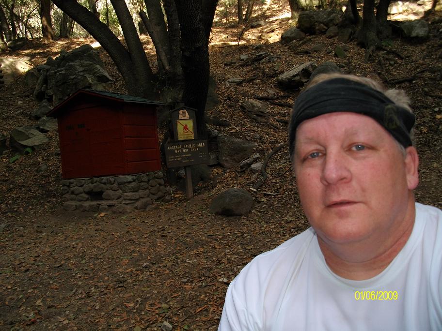
#15. Me at Cascade picnic area. This is a pretty spot. The sign says it's only half a mile from here to Spruce Grove, but I think it's more like a mile.

#16. Spruce Grove campground. This is a delightful place to camp, but the campground is empty. My first backpack trip was here when I was a new Boy Scout at eleven years old, using equipment I had borrowed from my cousin Bob.

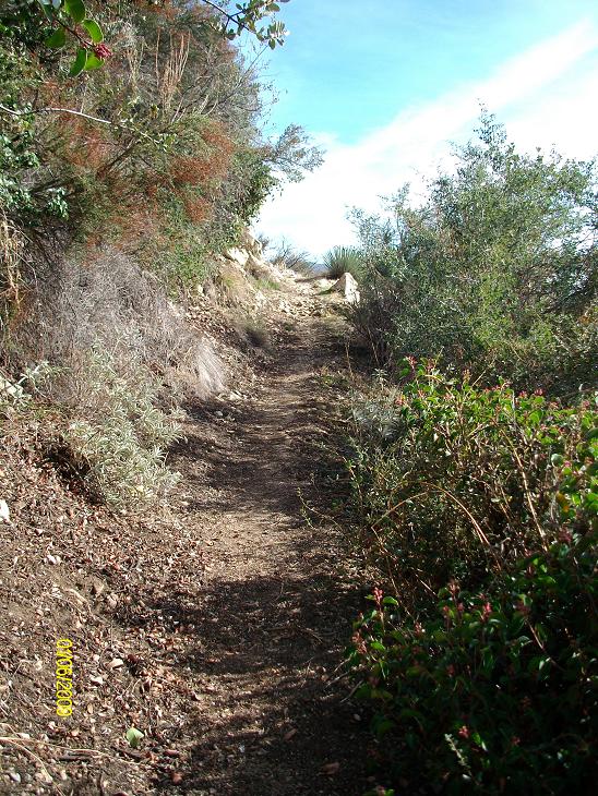
#17. I think these mileages are pretty accurate.

#18. When I got back to my sister's house my nephew greeted me at the door and said "You're a mess. What happened?" "Well, there was this tree..." There was no getting around this one. Trail crews have already cleared a lot of its branches. I wonder if they will even try to clear what remains. I was on my hands and knees going under it.

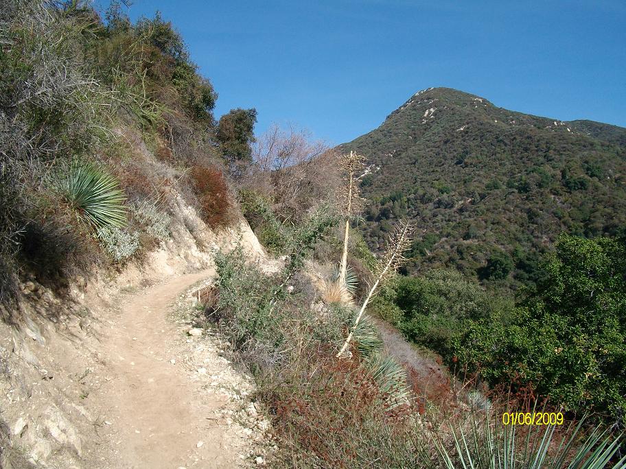
#19. From Spruce Grove to Newcombs Pass is uphill every step of the way. I paced myself (slowly) and was pleased with how well I did, stopping only for pictures. It is so much nicer hiking this in January than in August as I have done before! Newcombs Pass is somewhere along that ridge.
#20. Keep going.

#21. It is quite a surprise when you come around one curve and get a nice view of Twin Peaks.

#22. Chantry Flats is back there somewhere. Alas, haze is filling the canyon.
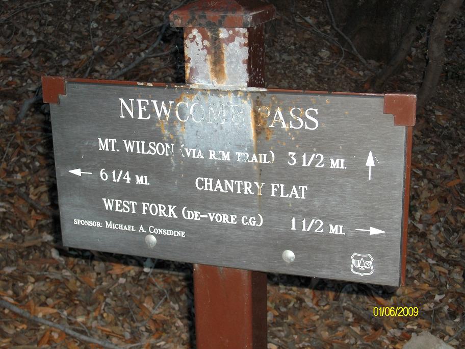
#23. Trail sign at Newcombs Pass.
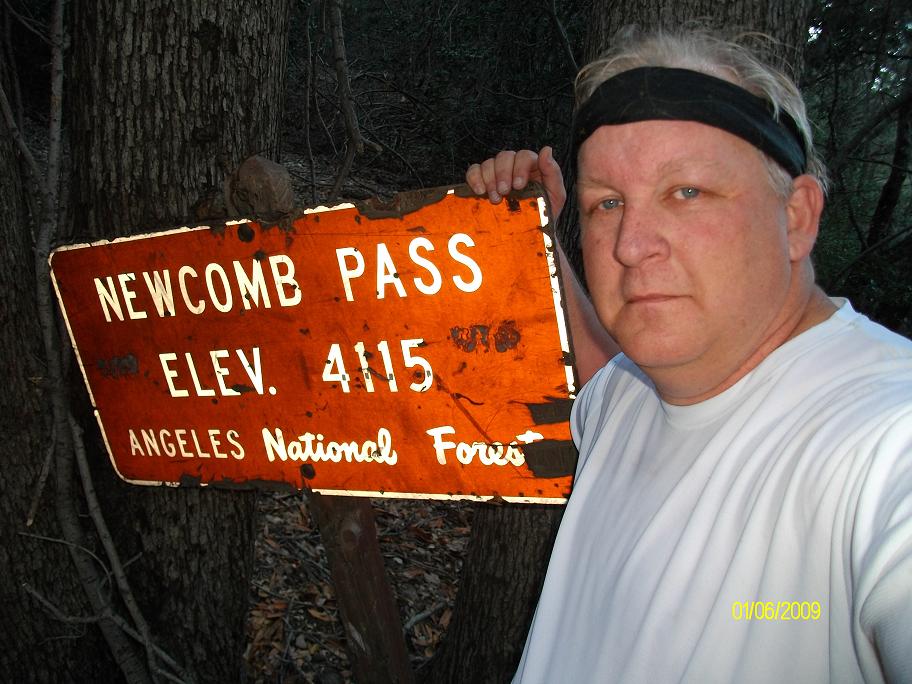
#24. Me at Newcombs Pass.
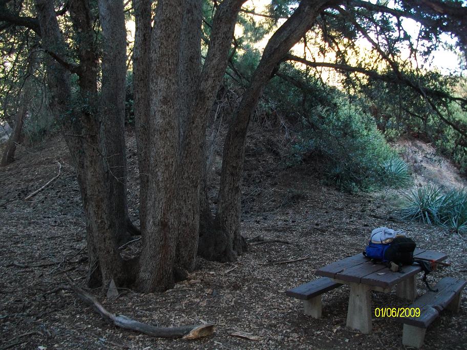
#25. Picnic table and cool tree at Newcombs Pass. I wonder how many backpackers have laid their packs down on this table over the years as they celebrate completing their climb.

#26. Now it's downhill every step of the way to DeVore trail camp. At my age, the downhills seem to take their toll more than the uphills!

#27. As you come around one bend in the trail, there is a nice stand of Manzanita bushes. This one had branches 4-6 inches in diameter.
#28. I made it. It's not dark yet, it just looks that way because of the flash on the camera. But it will be dark soon. It is, afterall, January.
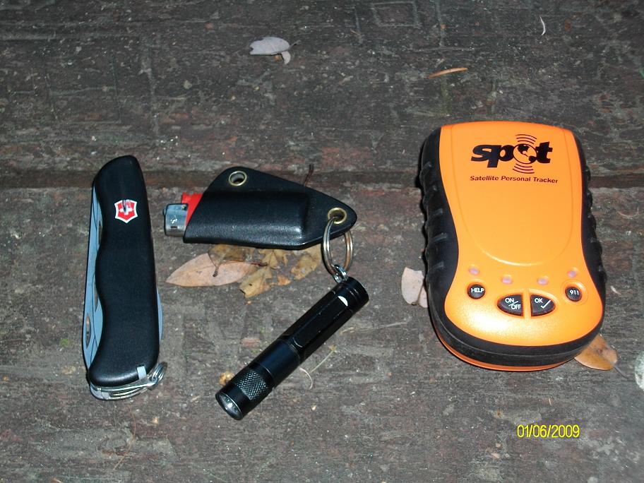
#29. This was my first time using my SPOT transmitter. I bought this last summer for a trip which was subsequently cancelled due to a change in my work. I bought it because I have a history of cellulitis which strikes without warning and results in an almost instant high fever. After having six episodes in one year, I haven't had an episode in 14 months, but this still seems like an appropriate precaution to take. Better safe than sorry. It is peace of mind for me and my family. For those readers who hike the San Gabriels, you'll be pleased to know that "OK" messages were successfully sent from Newcombs Pass and from DeVore.
SPOT message from Newcombs Pass:
Latitude:34.2326
Longitude:-118.0273
Nearest Location: Rincon Red Box Rd, , CA, US
Distance: 0 km(s)
Time:01/06/2009 16:15:10 (US/Central)
http://maps.google.com/maps?f=q&hl=en&geocode=&q=34.2326,-118.0273&ie=UTF8&z=12&om=1
SPOT message from DeVore trailcamp:
Latitude:34.2431
Longitude:-118.0359
Nearest Location:not known
Distance:not known
Time:01/06/2009 20:39:53 (US/Central)
http://maps.google.com/maps?f=q&hl=en&geocode=&q=34.2431,-118.0359&ie=UTF8&z=12&om=

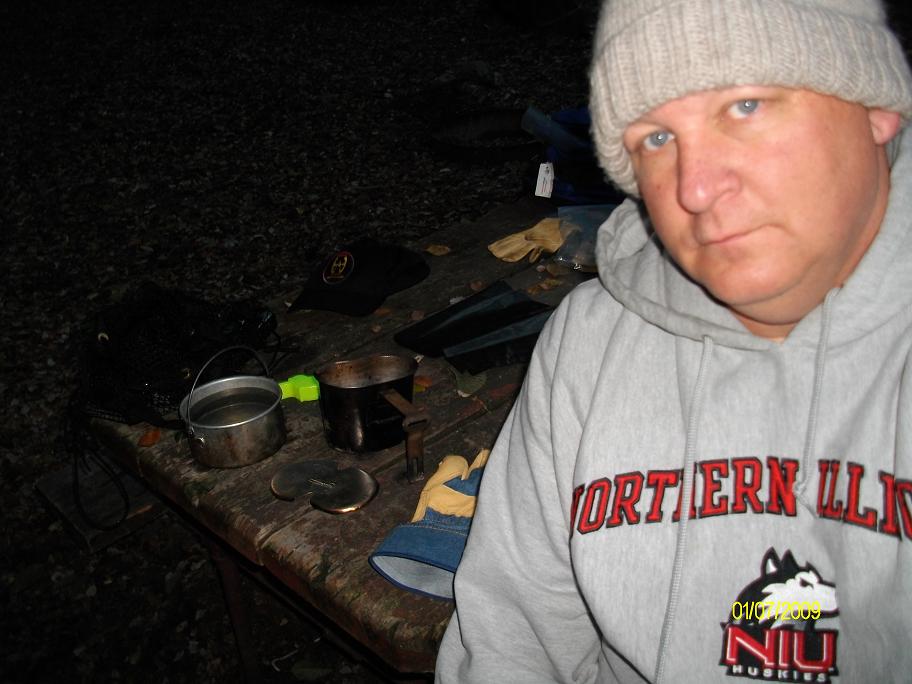
#30. I had planned to cook on my MSR Pocket Rocket stove, but the fuel canister protested to the cold. I don't usually build a fire when I am camping alone, but it seemed like a nice idea in January. I heated water in my canteen cup, which is fitted with a lid fashioned by "ML".

#31. The fire helped to keep most of my demons at bay.

#32. My campsite in the morning. No tent, just sleeping in the open. It was a pleasant night with about 3/4 moon, but it was a cold breeze coming down the canyon. I am, afterall, camped next to a creek.
#33. Howdy.
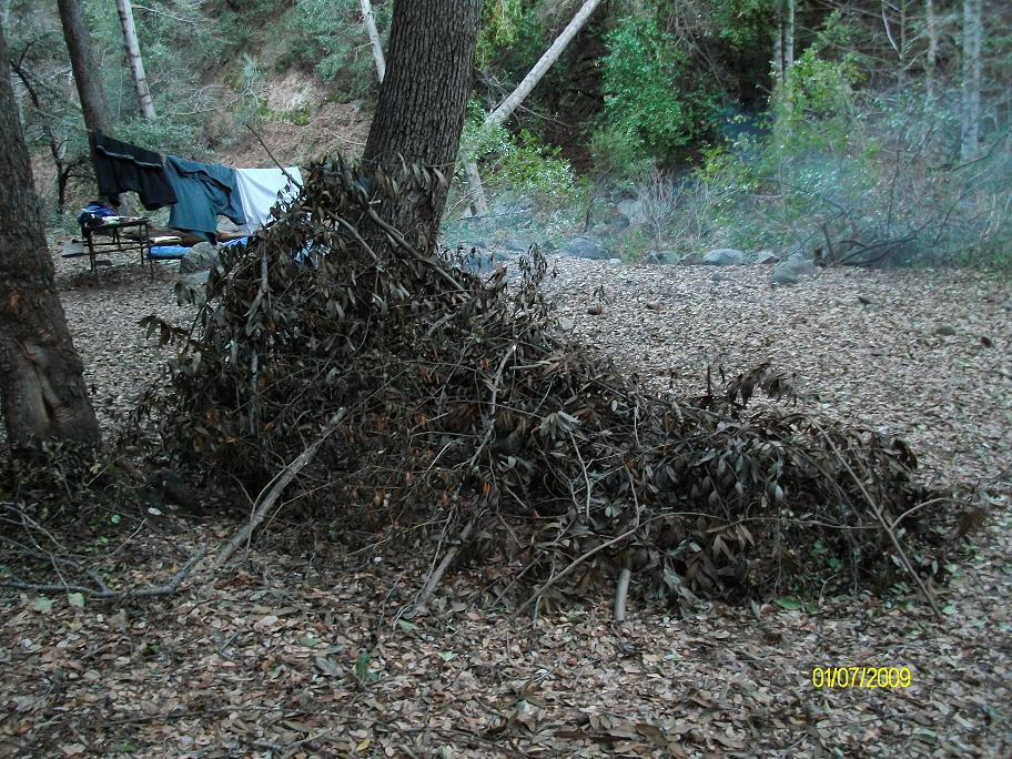
#34. Someone had attempted to build a survival shelter at the campsite. They clearly put a lot of effort into it before calling it quits. They must have realized -- perhaps too late -- that building a shelter is a very time consuming activity, even if you have plenty of materials at hand. I think the most important lesson you learn from shelter construction is to carry your shelter with you!

#35. After breakfast, it was time to head back up to Newcombs Pass. Uphill every step of the way. Again, I proceeded slowly, but I was pleased with how well I held up, stopping only for photos. This is the only snow I saw on this trip.

#36. The sun peeking over Newcombs Pass. I made it!

#37. A morning view of Twin Peaks from just below Newcombs Pass.

#38. And now it's downhill for about five miles. As I was walking down, I was thinking "this would be tough hike going up." Oh yeah, I just did it yesterday!

#39. In the distance you can see where Santa Anita Avenue ends at Chantry Flats. It's about 5.5 miles away by trail.

#40. Zoomed in. You can clearly see the parking lot.

#41. Mt. Harvard (left) and Mt. Wilson (right).

#42. A friend of mine recently told me that when they cleaned out her father's old stuff, they threw away all pictures that didn't have people in them. I suppose by that criteria that most of my pictures are "throw aways". So you better enjoy them now....
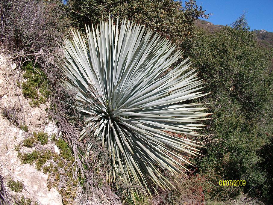
#43. A spectacular trailside yucca.

#44. California buckwheat, which can be used to make biscuits as shown on this page.

#45. I took this picture for my friend Brian Field. Yes, Brian, it's still there.

#46. A friendly face greets me as I arrive at my car parked at the Chantry Flats pack station.
Copyright © 2009 by Bill Qualls. Last updated Jan 07, 2009.
Back to my survival page.